Showing posts with label storm. Show all posts

Monday, January 10, 2011

Beach Sediment & State Park Pics - 1-10-11

December Storm Sediment Deposits.   There was much concern a month ago (on 12/12/10) when heavy rains caused Illahee Creek to overflow its banks and filled the stream with sediment.  The velocity of the stream successfully carried the sediment through the culvert and deposited it on the flood plain and at the mouth of the creek.  We have been monitoring the culvert to see if the emergency clean out of the downstream end of the culvert is helping and will be reporting on that in a later update.

High Daylight Tides.  Because of the high daylight hour tides, it has been difficult to look at the sediment deposits in the nearshore area, that is until this past weekend.  We took some pictures and videos of the sediment deposits.  The first photo looks south at the mouth of the stream.  The second looks north toward the Illahee community dock.  The raised area to the north used to look more like a valley or depression (to give you a visual image of what it looked like before the storm), and is an indication of the amount of sediment that was deposited by the December storm waters.


Concerned Residents.  We have heard from some of the residents near the mouth of the creek who were amazed at the sediment buildup from the December storm.  Below is an email of from a local homeowner who has evidently been impacted with increased flood insurance requirements.

As the owners of one of the properties at the mouth of Illahee Creek, we have certainly noticed and been concerned by the increased sediment in Dr. Schutt's reservoir and the entire basin.  However, It seems there is too much focus on the culvert as this will not impact the rising elevation or sediment build up at the mouth.  This is presently impacting home owners and the community as the sediment build up effects the marine life in the bay, as well as the elevation of the flood plain.  The real problems lie more up stream with the flow of water and amount of sediment entering Illahee Creek and flowing down stream to the mouth as you noted below.  Correct that problem and you will not need to raise the culvert.  We would love to see more dredging or digging out of the flood plain even a few truck loads as a nice gesture as this problem has already cost home owners in the area with mandatory flood insurance requirements from mortgage lenders. 

Our Comments.  We concur with the above letter about the need to correct the upstream storm surges and the fact that the large sediment deposits are affecting marine life.  We are not sure though, that there is enough money or the environmental approvals necessary to dredge out a raised flood plain.

Illahee State Park Creek Sediment?  It appeared to us that there were some significant sediment deposits at the mouth of Illahee State Park creek, which is at the north end of the park.  We haven't talked much about this small creek, but it a recognized creek by the state, and is monitored by the Health District.  If anyone has information on whether our observation of the sediment buildup is correct, please let us know.

Illahee State Park Improvements.  We have been asked how the Illahee State Park sewer improvements have been progressing.  The park has been closed because of the ongoing work and we have not talked with the park rangers, but we did take some pictures near the beach parking area, during a beach walk on Sunday.  If you have any information on the progress, please let us know so we can pass it on.


Wednesday, December 15, 2010

Orca Video & After Storm Issues - 12/15/10

Orca Sightings in Illahee.  About 9 am today (12/15/10) we received a call that some orcas were going north through Illahee.  By the time we looked out they had disappeared.  Then later in the day we were notified there were several out front.  We grabbed a camera and got some video as they passed by.  It wasn't until we looked at the video tonight that we realized there were two adults and a young one.

Kitsap Sun Report.  In Thursday's Kitsap Sun will be an article about others who saw them and where they have been.   Click on the following link to read the article:   http://www.kitsapsun.com/news/2010/dec/15/transient-killer-whales-seen-in-kitsap-waters/

Seal Seen Hugging the Beach.  We also had a report that as they went by a seal was seen close in by the beach, evidently trying to stay away from danger.

Video on YouTube.  With some help from one of our children, we were able to upload the video of the orcas on YouTube.  The link is: http://www.youtube.com/watch?v=rduYVcEyS1w

After Storm Pictures.  With a borrowed camera we were able to take some pictures of the effect of the storm on the Illahee Creek culvert and the tons of sediment deposited near the mouth of the creek.  


Notification of Emergency Illahee Creek Dredging.  It also appears the county will be dredging material from the downstream end of the culvert.  See the attached email from WDFW.  We have also attached the signed HPA (Hydraulic Project Approval) form.

I just wanted to give you a heads up that an emergency request was made by Kitsap County to remove sediment at the downstream end of the culvert. They will likely be mobilizing in the next few days. The HPA is attached for your information.
Thanks,

Gina Piazza
Area Habitat Biologist
Washington Dept. Fish and Wildlife
450 Port Orchard Blvd, Suite 290
Port Orchard, WA  98366
Phone: 360 895 3965
Fax: 360 876 1894

Response to the Dredging.  We received the following response to the dredging from Judith Krigsman, who gave us permission to print her concerns.

I find the current plan to clean out the culvert located at 5140 Illahee Road most concerning.  As the property owner at the inlet side of this culvert I can’t imagine how this is going to help the current situation.  It appears that the problem existing on my side of the culvert at 5171 Illahee Road is the side that needs fixing.  As I watch the floodplain rise on my property and see the amount of sediment that is all but totally filling this newer culvert, the ticking time bomb will still exist for road washout even if an emergency cleanout is activated.  The actions by others including the work done by the current owner of this property is creating havoc on the flow of this amount of velocity of water and sediment during these storm events.  The kink which has been taken out of the stream which served a purpose of slowing down the water during these events is now being allowed to wash out the entire point.  Just look where all the sediment is now resting on the property adjacent to the site of the proposed cleanout.  I do believe a meeting should be held immediately to talk through some of these issues before another cleanout takes place.  Illahee Creek is a dynamic water system; this practice of emergency clean-outs is not the fix which needs to take place, let’s talk!

Our Thoughts.  After seeing the amount of sediment that has been deposited at the mouth of the creek by this last storm, literally tons, there is no way that removing a few dump truck loads of sediment will do much of anything.  It is a nice gesture, but it isn't getting to the sources of the problem, which are the storm surges coming primarily from the area north of the golf course.  

Not a New Problem.  The culvert issue has been known by the county for some time, but they needed a watershed study before they could do anything.  The Port of Illahee put in for a grant with DOE and together they paid for a comprehensive watershed study that was completed by Parametrix.  The fixes come with a multi-million dollar price tag, which emphasized the need for the county to obtain the golf course, as it is the logical place to try and restrain the problematic storm water surges.  The community is crossing their fingers that the golf course gifting paperwork will complete soon so that stormwater restraining projects can begin.

Raised Flood Plain.  What is interesting about the Illahee culvert situation is we are essentially dealing with a flood plain that steadily increasing in elevation with each storm.  A Timbers Edge report stated the elevation downstream of the culvert increased 18 inches from the December 2007 storm.  Upstream of the culvert, the reservoir that Dr. Schutt put in years ago, has filled with sediment.  With the flood plain rising on both sides of Illahee Road, and short of digging out the whole flood plain, the only solution many see is raising the height of the culvert. 

Your Thoughts On This Issue?  Please let us know your thoughts on the stormwater/culvert issues as a possible failure of the culvert would affect everyone who travels this portion of Illahee Road.

Jim Aho

Tuesday, December 14, 2010

Some During Storm Pictures - 12/14/10

Storm Pictures.  We have been asked where the storm pictures are since our last Update had some 'Before Storm' pictures.


Non-Water Proof Camera.  We got up early last Sunday morning and took a few stills and some video of the effects of the storm.  We found out that the use of cameras during heavy rain events does not work well for non-water proof camers.  Our camera was sent to the manufacture on Monday in hopes it can be repaired.  Our film maker, Shelly Solomon, did some good photos in the afternoon.  When we walked to the mouth of the creek and were amazed at the number of golf balls that had been washed down the creek and out on the beach.

Some Pictures Were Retrieved.  We got some help retrieving some of the photos from the camera and will look at how to get some of the videos on an Update, or at least linked.  This is a learning process for us.

Illahee Creek Culvert.  The Illahee Creek culvert was running nearly full.  The attached photos show the brown water and the culvert.

Brown Water.  Those who live along the water regularly see brown water coming from the creek anytime there is a rainfall of over an inch in a short period of time.  During major storms the brown water is much more distinctive as shown in the photo from the Illahee community dock.

Phone Calls & Emails.  Thank you for the phone calls regarding the storm and for the emails.  Attached are two that go into some detail.

Ran down to the Illahee culvert about an hour ago and the water is within 12 inches of the top.  The velocity and volume of water is such that no sane person would attempt to cross the creek.  
Wash-out at the top of Oceanview with baseball size rocks in the roadway.  I unplugged 4 catch basins on the upper half.  The water has cut nearly a foot below the blacktop up hill of the debris and I am going to call this into the county immediately.
Found a plugged culvert at the bottom of 3rd Street on the South side of the road.  The results are gravel, and washout debris on Illahee Road.

Took a tour of the stream channel as it appeared after the waters have had a chance to settle down.  The picture presented today shows a culvert which has vastly changed as is as close as it gets to failing.  We were within probably 2 inches of complete failure as the banks of the floodplain took a real beating.  The incised area along the stream showed that we had over 30 inches of water trying to get through the culvert and ended up spilling onto the floodplain.  All it would have taken was for one of these logs to try and get through the culvert.  They are now in a position to move forward with the next storm event.  I must say that this is very discouraging for fish and folks like the Krigsman's who own the land that this failed  culvert sits on.  We need to notify the county that they have installed a product  that needs replacement.  Additionally, by taking the bend out of the stream on Mossano's side they are losing the entire Schutts  point.  How is it that those in the know, fail to understand the dynamics of water and how the velocity controls everything? 

Amazing Deer Photos.  We received some amazing deer photos we will include more in a future wildlife update and have attached one to this email.  

Thanks For Sharing.  Thanks to all those who share your photos and for your comments!

Jim Aho

Saturday, December 11, 2010

Miscellaneous - 12/11/10


Illahee Creek Culvert.  The culvert under Illahee Road wherein the waters of Illahee Creek flow, has been a concern for the Illahee Community for some time.  The December 3, 2007 storm filled the culvert with sediment and if a big log had come down and plugged the culvert it would likely have washed out Illahee Road.  With the current storm approaching we are watching the culvert closely, and some big upstream logs.  Attached are two photos, the first shows the culvert with a 32 inch clearance, and the second shows some big upstream logs.


Guard Rail Installation Complete.  The guard rail installation along Illahee Road completed on Friday across from Fisher Park (see photo).  It wasn't without some problems as a North Perry Waterline was ruptured in the process.  Many realized something had happened as the turned on their facets and found brown water.  It happened around noon on Thursday and was repaired quickly and the brown water also went away.


Restoration Signs in Preserve.  Two restoration signs were installed in the Preserve on Friday.  One was to secure an unauthorized trail, and the other to note the future restoration in the area commonly known as Golf Course Hollow, where stormwater is a problem (see the last photo).


Eagle Scout Signs Missing.  We were extremely disappointed to see that in less than a week some of the trail signs that Justin McAlister and his Boy Scout troop had put up (last Sunday), had been removed.  Attached is a photo of some that are still there plus the empty spot where one was last Sunday.  We received comments about how nice they were and how helpful it was to have them there from those who walk the trails daily.  If anyone has any information on who is taking the signs please let us know.

Horse Comments.  We received a number of comments regarding the two Updates that explained the horse situation.  What was new to us was that several mentioned that their dogs either liked to roll in the horse droppings, or would eat it. 

Before the Rain Photos.  We took some other photos this morning before it started to rain.  Attached are photos of the big pond under the power lines near the end of Johnson Road (north of the golf course).  This big pond is the headwaters of the north fork of Illahee Creek and also the headwaters for one of the branches of Steele Creek.  We also took photos of the detention facility at Illahee North.  The water was overflowing from the detention pond where it is essentially tightlined (except for 150 feet) to the outfall at the Illahee community dock (see photo).


Wood Duck.  When taking our 'before the rain' photos we noted a wood duck swimming with two mallards.  It is a first sighting for us and we were glad to get the attached photo. 

Wildlife Update Coming.  We have a number of photos that we need to pass on regarding wildlife and promise to do so soon.  We have been asked to increase the kilobyte (KB) size of our photos so they are easier to view.  We are still learning on how to do this and attempted to do so with our last photo. 

Jim Aho

Wednesday, November 24, 2010

Miscellaneous - 11/24/10

November Winter Storm.  Monday's snowfall and then later in the day and early Tuesday, the cold north wind has left its mark on Illahee.  Tuesday morning found trees and power lines down, evidently from some wind gusts from the west, and icy roadways.  We went walking around part of Illahee on both days and the difference was striking.


Another Chipmunk.  On Monday we saw a chipmunk scouring for food in the snow, and wondered why it wasn't hibernating.  We think by Monday evening it was wondering the same thing.  We have heard that chipmunks hibernate in the winter and expect that is true, but we were told by the property owner that this guy was back at his bird feeder on Tuesday in the frigid weather.
Young Deer.  We also watched a young deer on Monday as it seemed fascinated by the snow.  Unfortunately is was snowing hard at the time and the photo of the deer at the side of the road is obscured.

Leaning Power Pole.  This leaning power pole on East Blvd was reported to us early Tuesday morning and was taken care of by late in the afternoon.

Trees Down.  Not only did some people loose power Monday evening, but they were having problems getting out of their areas due to fallen trees.  The fallen tree photos were from Quinault Drive, Sunset (East End), and Hicks Ave.  The Sunset tree took down the power line and left bare wires on the ground.


Power Outages.  There were lots of power outages in Illahee (which goes from 30th Street on the south end, to University Point on the north end), which have mostly been taken care of from what we have heard.  Those in the more central or historic part of Illahee were more fortunate with this storm as they only had some power fluctuations.

Humming Birds.  On Tuesday morning we had a report of 5 humming birds sitting on this feeder, and another one close by, evidently waiting for the sun to thaw the frozen sugar water.  We asked them for a picture but they could only get two of them at the feeder.

Photos & Reports.  If you have any photos or reports you would like to share, please send them on.

Jim Aho

Tuesday, May 18, 2010

Report of Monday's Meeting - 5/18/10

Illahee Community Meeting Monday Evening (5-17-10). We attended the Illahee Community meeting on Monday and found out that many have been working quietly behind the scenes to protect and preserve Illahee interests.

Meeting Times Discussed. This meeting was held on a weekday (Monday) evening rather than a weekend and it was the consensus of most that they preferred a weekday evening over a weekend meeting.

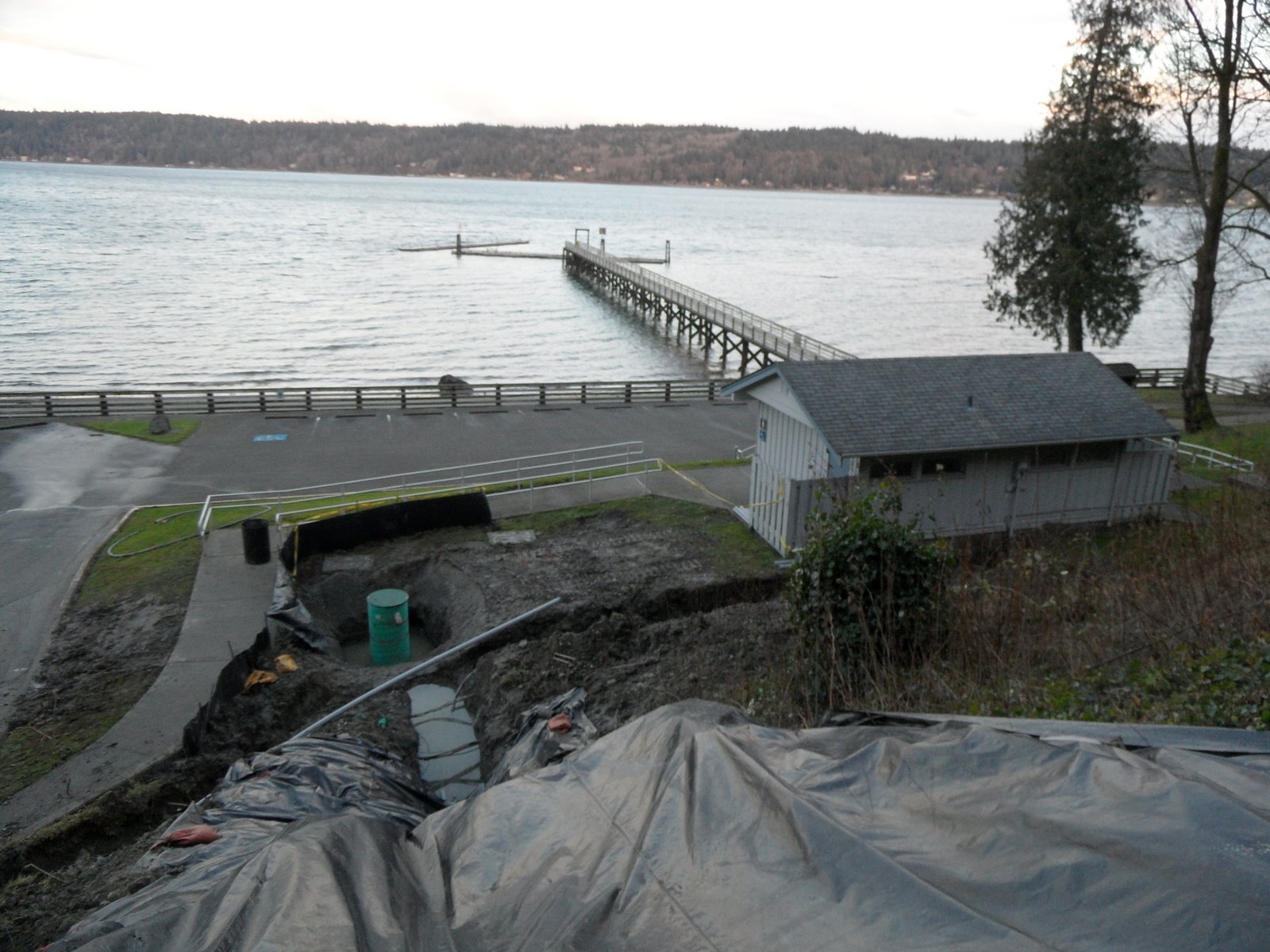
Storm Surge Area Identified. Over the years many Illahee residents have wondered where the storm surges originated from that were polluting Illahee Creek and Puget Sound. We saw a map of some 130 acres of land north of the golf course with roads and approximately 400 home/trailer sites where most of the storm water from that area is piped directly under McWilliams Road to the ravine in front of the golf course bridge. When that surge of storm water hits the deeply incised canyons of Illahee Creek it picks up sediment that is carried down Illahee Creek and out into Puget Sound where it can be seen for miles. Many had no idea of the size of that area that was draining (being tight-lined) into Illahee Creek and it helped explain where the surges were coming from and why they had such a devastating impact on the creek and the Sound.

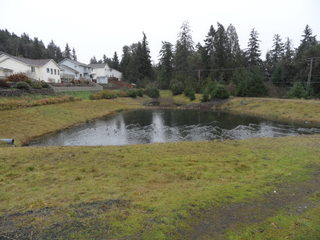
Rain Garden Target Area. Portions of that area are now being targeted for rain gardens to see if they can start to mitigate the surges. The Kitsap Conservation District (KCD) has a Rain Garden Cost Share Program that will help reimburse residents in unincorporated Kitsap County with up to $500 per rain garden (applications and details are available from KCD).

Map of Master Plan. Also presented was an updated Master Plan map showing Phase 1 (completed) and Phase 2 (future) Acquisitions and Conservation Easements, which are needed for the Illahee Preserve/Illahee Creek Restoration Project. (Note that the map is part of the attached partition.)

Illahee Creek Restoration Project. The purposes or goals of the Illahee Creek Restoration Project were presented as they realized many are unaware of the extent of the project. We have included that information below:

The purposes (goals) of the Illahee Creek Restoration Project are: (1) to acquire Illahee Creek riparian corridor properties including those that constitute prime salmonid spawning and rearing habitat; (2) to restore salmonid use to near historic levels; (3) to restore the natural ecological processes of the riparian corridor and the watershed; (4) to control the storm water surges and excessive sedimentation that plague Illahee Creek and Puget Sound (through retention and bio-retention facilities); (5) to raise the height of the Illahee Creek culvert to compensate for the raised flood plain in the lower reaches of the stream and to prevent the possible washout of the culvert and Illahee Road; (6) to eliminate fecal coliform sources that pollute Illahee Creek; (7) to restore aquifer recharge to levels that support the base flows in Illahee Creek necessary for salmonid use and survival; (8) to inform and educate the local community and the public at large regarding the above issues and involve them in the restoration processes, and(9) to facilitate public use and enjoyment of the anticipated restored natural features and ecological processes of the Illahee Preserve and Illahee Creek.

While Illahee Creek is only a small salmonid player in the West Sound Watersheds area, with only small runs of chum and coho in a good year and intermittent use by steelhead and cutthroat, it is a major polluter of Puget Sound with excessive amounts of sedimentation being deposited into the Sound during storm events. And although much of its stream corridor and watershed consists primarily of prime habitat (65% undeveloped with most of that protected), a relatively small area of early development, constructed before storm water mitigation regulations went into effect, has resulted in over 40 years of excessive sediment pollution of Illahee Creek and Puget Sound. Additionally, Illahee Creek is also impacted by diminishing low base flows during times of low precipitation, along with the presence of fecal coliform pollution in the stream.

Note that significant progress has been made over the last few years to begin to document the issues and accomplish some acquisitions and some restoration, primarily through earlier grants (Recreation and Conservation Office (RCO), National Fish & Wildlife Foundation (NFWF), Coastal Protection Fund (CPF), and Department of Ecology (DOE)). It is estimated that roughly 15 -20% has already been accomplished.

Note also that the Illahee Community, the Port of Illahee, the Illahee Preserve support groups, and Kitsap County have additionally committed resources and are working collaboratively to accomplish the purposes and goals of the restoration project, with financial support, volunteer labor, inter-local agreements, etc., and by applying for available grants to keep the project goals moving toward completion.

Legal Issues. The appeals by the community to Superior Court and the Shorelines Hearings Board (SHB) were discussed with both being settled and dismissed. We will cover the SHB dismissal because it affects what happened next in the meeting.

SHB Dismissal. The dismissal order from the Shorelines Hearing Board was issued earlier this month along with a copy of the "Settlement Agreement." The "Settlement Agreement" had a number of items associated with it and we will try to give a brief summary of the document. There are two main items with the first being that the developer will gift the open space lands to the Illahee Preserve if the SHB appeal is dropped. The second item being the developer will give the Port of Illahee an option to purchase the Timbers Edge properties and they will not begin development until later this year to give the Port time to decide whether they are interested.

Port Position. The Port Commissioners have stated that as elected officials they want to support the community so they need to know what the residents want. The community asked them what they needed and they responded that if over half of the number of voters in the last elections agreed that they should purchase the property which would necessitate raising the tax rate, they would consider it. Roughly half of the residents voted in the last elections (1000 out of roughly 2000 registered voters). This means that the Port would be looking for 500 plus residents to say they would support the Port's actions necessary to purchase the property.

Port Petition. As a result of Port's position, the Illahee Community has come up with a petition drive to see what the will of the people is with regards to the Master Plan and with Timbers Edge. We have attached the complete petition to this email and have included the petition verbiage below:

Petition to Help Save Illahee Creek & Puget Sound

+++ Request for Citizen & Port Help! +++

Background:

Illahee is endowed with unique natural features that have resulted in a state park, a community dock, a salmon stream, a large park/nature preserve, and a golf course.

Illahee State Park and the Illahee Preserve purchases were the results of community campaigns to preserve these areas.

The Illahee Preserve was recently expanded (from 352 to 460 acres) through grants and community action (Phase 1) to help protect Illahee Creek.

Excessive sedimentation nevertheless continues to destroy salmon habitat, pollute Illahee Creek and Puget Sound, and threatens to wash out the culvert under Illahee Road. Immediate action is needed to obtain critical watershed properties to help protect the stream and Sound (Phase II).

Fish are also threatened by low base flows (during non-rainy periods). Critical aquifer recharge areas, such as the Timbers Edge properties, are needed to support rain water infiltration necessary to resupply the aquifers and help keep Illahee Creek a viable salmon stream.

Petition:

We call on citizens to sign this petition and request the Port of Illahee to take the following actions:

That the Port look at grants and means to control the storm water surges that plague fish, Illahee Creek, and Puget Sound, and will impact the community if Illahee Creek culvert washes out.

That the Port pursue grants and other means to protect/secure Illahee’s critical aquifer recharge areas, such as the purchase of the Timbers Edge properties (a willing seller).

That the Port pursue grants and other means to restore Illahee Creek as a fish bearing stream.

That the Port look at means to perpetuate Rolling Hills as a community golf course open to the public.

We understand the “other means” will necessitate temporarily raising Port taxes (a maximum increase of $126 per $250,000 assessed value) for several years, but that the property purchased from these additional taxes will produce revenues that will then decrease Port taxes in the future.

We need to have approval from 500+ residents before the Port will act.

Please return ASAP to:

ICC Petition to Port of Illahee, PO Box 2563, Bremerton, WA 98310

Or give to an Illahee Community Club member who will forward it on.

--------------------------- Please tear off and return the section below, and keep the map & write-up as a reference. ----------------------

_____Yes! I agree with the petition and add my signature in support of the Port taking these actions.

_____No! I am sorry but I cannot support the petition. (Please let us know your reasons.)

Comments: ______________________________________________________________________________

______________________________________________________________________________

______________________________________________________________________________

______________________________________________________________________________

NAME _____________________________________SIGNATURE__________________________________

ADDRESS __________________________________________EMAIL__________________________________

CITY, STATE, ZIP ___________________________________________________PHONE__________________


500 Plus Signatures Needed. As you can see this will be an ambitious task to obtain 500 signatures from the registered voters within the Port of Illahee boundaries (which are essentially the Illahee Community boundaries, with a few exceptions).

Meeting Vote. After a lengthy discussion time with many questions asked, a vote was taken, which passed unanimously. The Port Commissioners stated they would hold additional meetings to give other opportunities for residents to ask questions.

Your Thoughts?. This is a crucial decision point in the life of Illahee and we would like to get your thoughts, whether your agree or not with those who attended the meeting.

Jim Aho

Monday, April 14, 2008

3 Meetings This Week - 4/14/08

TUESDAY (4-15-08)

11AM -12:30 PM Norm Dicks Center - KC Department of Emergency Management (KCDEM) December 2007 Disaster After Action Symposium to address the county's response to the Dec 2007 storms. In Illahee we had more than our share of problems with this storm even though we received less rain than other parts of the county. Some of us want to express our thoughts with what happened and more importantly, what lessons were learned that will help in the future. More information on this meeting was in the 4/5/08 CK Reporter which you can access by clicking on this link.

6 - 8 PM Sylvan Way Library - Illahee Community Plan - County Experts, Dave Tucker (stormwater), Patty Charnes (natural systems), David Greetham (environmental) will be giving presentations. This should be a very important informational meeting and one that you won't want to miss. These are the county experts who make the decisions on what happens in Illahee.


WEDNESDAY (4-16-08)

6:30 - 8:00 PM Fairgrounds Parks Dept Offices (lower level) - Illahee Preserve Stewardship Committee meeting (open to the public). This is the group that keeps the Illahee Preserve going. They are always looking for new members to help them with the management and oversight of the 460 acres that comprises the Preserve.


If there are any questions on these meetings, please give me a call at 479-1049


Jim Aho

Sunday, March 9, 2008

Gilberton Creek Culvert Replacement - 3/9/08

We have heard from a number of people this weekend who would like a briefing from the county on the Gilberton Creek Culvert Replacement, which is at the north end of the Illahee community.

On March 5th Kitsap County issued a DETERMINATION OF NONSIGNIFICANCE. We have copied a portion of the document which reads as follows:

DETERMINATION OF NONSIGNIFICANCE

Description of Proposal: Illahee Road Culvert Replacement – Replace a failed undersized 18 inch culvert with a ten foot diameter culvert constructed for fish passage. The proposal includes repair of storm damaged stream banks, upstream and downstream channel repair, and placement of gravel in the stream bed to enhance fish passage.

Proponent: Kitsap County Department of Public Works

Lead Agency: KITSAP COUNTY

Location of proposal, including street address, if any: On Illahee Road at an unnamed stream tributary that flows to Port Orchard Bay, approximately 1.5 miles south of the intersection with Brownsville Highway, near Gilberton.

The lead agency for this proposal has determined that it does not have a probable significant adverse impact on the environment. An environmental impact statement (EIS) is not required under RCW 43.21C.030(2)(c). This decision was made after review of a completed environmental checklist and other information on file with the lead agency. This information is available to the public on request.

0 There is no comment period for this DNS.

0 This DNS is issued after using the optional DNS process in WAC 197-11-355. There is no further comment period on the DNS.

X This DNS is issued under 197-11-340(2); the lead agency will not act on this proposal for 14 days from the date below. Comments must be submitted by: March 24, 2008.

COMMENTS:
The replacement culvert will improve capacity for stream flow and fish passage under Illahee Road. The in-stream work will be subject to Hydraulic Project Approval from Washington Department of Fish and Wildlife, and Nationwide Permit approval from the Corps of Engineers.

Responsible Official / Contact Person: David Greetham
Position/Title: SEPA Administrator, Dept. of Community Development Phone: (360) 337-7181
Address: 619 Division Street, Port Orchard, WA 98366


Nearly all the people we spoke with have some concerns, first about how the washout happened, and second, they want to be briefed on the project, and possibly having some input, as the project goes forward.

We are forwarding this update to Commissioner Josh Brown, KC Public Works, and the Department of Community Development, to see if they can set up a briefing for the Illahee and Gilberton communities regarding the culvert replacement.

Jim Aho

Thursday, January 24, 2008

Storm Report #1 - 1/24/08

Storm Reports We are requesting any December storm related photos you might have so we can put them on our website illaheecommunity.com. We also would like to invite you to our blog site which is on the website or at illaheecommunity.blogspot.com so you respond to these updates and see other responses.

Storm Rainfall We were lucky in Illahee to escape any injuries related to the storm, though we did have plenty of storm water damage. We have a rain reporting station in Illahee which reported 2 inches on Sunday (12/2/07) and 6.4 inches on Monday (12/3/07), and thus we did not receive as much rain as other locations in the county.

Photo Documentary On our website is a photo documentary by John Lind of the washout of Illahee Road (note the photo that shows a person at the bottom of the washout with two people looking down from the road). His writeup of the washout is provided below,

Some said 14 inches fell in 48 hours, others reported 11 inches, and in Illahee it was actually about half of that, but we won't argue, cause it was enough to inflict considerable damage to the area on that Monday, the 3rd day of December in 2007. Illahee Road had some major problems with near washout at the south end above Rue Villa, a culvert and estuary at Illahee Creek that filled with sediment, and a total road washout at the Gilberton Creek gully, thankfully without the loss of life.

There were several who crossed the roadway just before it blew out. They reported few people on the road at that time (about 1:30 pm) and a water filled upstream gully that was overflowing across Illahee Road about 2 inches deep and at least twenty feet wide.

We decided to walk the area and the path the water took after it washed out the Illahee roadway just northwest of Grahns road where the next curve starts. We climbed and slid down the bank which must have been 50 to 60 feet deep when we reached the bottom. You could hear the water still running in the broken culvert and over the gravel.

Heading down the newly sculpted gully, we climbed around some big cedars that had been nudged over by what we estimated was a "water wall" of 50 feet or so high as it broke through the road bed. As we rounded the first bend you could see about a block ahead the area had widened out to about 40 feet and was still 18 to 20 feet in height where the banks and tree trunks were scarred by the rushing torrent. I think the most extra-ordinary sight was at the next turn where the area became wider than 100 feet and still had scoured the area to 14 feet high. Hugh chunks of 8 inch thick blacktop were strewn downstream, a guard rail was wrapped around a tree trunk, and trees were piled up on the curves so high that a person with a 7 1/2 foot reach couldn't touch the top logs.

We could just imagine the sounds that must have been heard by the people living in their homes high up on the banks overlooking the gully. Talk about a freight train coming thru the woods! Wow! Some of the walls were scoured so drastically it showed different strata of compressed clay and dirt that probably were formed back in an earlier glacial period. It wasn't a difficult walk as everything in the gully was washed out into Port Orchard Bay. As we rounded the last bend and could make out the water up ahead we realized that we were walking on mud flats where the tides were already working to reclaim the land.

Now the big questions are: What will replace the washed out roadway, and when will we be able to drive from Illahee to Brownsville again?

John Lind

Thursday, January 3, 2008

Illahee Creek Culvert 1-3-08

This update concerns the Illahee Creek culvert under Illahee Road. Many of us have concluded the culvert has failed and that another major storm could result in a wash out of Illahee Road. We sent the following email to Kitsap County personnel on Tuesday (1/2/08):


We are extremely concerned that the Illahee Creek culvert under Illahee Road has essentially failed as the result of the December 3, 2007 storm. We think this failure is the direct result of the storm and that federal disaster money needs to be applied for to fix the problem.

Another major storm would likely result in the further blockage of the culvert which could result in another major washout along Illahee Road.

The following statement appeared in the recently published Parametrix "Draft Illahee Watershed Characterization and Site Assessment" dated December 2007 which was authored by Erin Nelson and Derek Booth, and provides supporting professional documentation of our concerns.


Along the lower Main Stem and below Illahee Road, the consequences of high sediment loads and nearby base level (i.e., Puget Sound) were manifest in abundant deposition, a braided channel form, and the near-obstruction of the Illahee Road culvert. Based on local reports during the storm, filling of the culvert proceeded from downstream to upstream (i.e., not from an obstruction at the upstream end of the culvert) and almost certainly reflects the rapid delivery of sediment onto the delta of Illahee Creek that built a steepening wedge of sediment into the Sound. Local dredging of the sediment immediately downstream of the culvert has provided temporary relief, but additional high flows would almost certainly deliver sediment more rapidly than a backhoe could remove it. Long-term, a reduction of sediment delivery into Illahee Creek would allow the reestablishment of a reduced gradient between the creek and the Sound, lowering sediment levels in the culvert and recreating free passage. Given the improbability of this scenario absent dramatic efforts to resolve acute and chronic sediment inputs into the channel network, however, emergency maintenance and eventual replacement of the culvert appears almost unavoidable.


The filling of the old stream channel with sediment has significantly altered the stream flow at the mouth such that salmon passage is now questionable .

We have a stream with such a large sediment transport problem, caused by the lack of storm water controls, that it is effectively raising the height of the flood plain up and down the main corridor of Illahee Creek, including the delta at the mouth of the creek.

Some has suggested that the only way to solve the problem is to raise the height of the culvert or put in a bridge structure, which would mean raising the height of Illahee Road in the vicinity of the culvert. We will leave those decisions to the engineers, though they may appreciate some help at this point.

There are no easy solutions and no one has come up with any quick fixes. The recent backhoe work at the culvert outlet increased the opening at the upstream inlet by 3 inches (from a 19 to a 22 inch clear opening). We commend those efforts, but remind the county that the culvert will not likely handle another major storm.

The community needs to be aware of this situation as it is always the local citizens who are most impacted and affected when systems fail. We welcome your thoughts and comments.

Dennis Sheeran & Jim Aho

Saturday, December 15, 2007

Storm Update 12/8/07

It was heart warming traveling around Illahee this past Monday (12/3/07) during the storm. Residents were out keeping drainage catch basins and roadways clear of obstructions nearly everyplace we went. We were impressed also with county employees who were working in the area. We noticed a number of slides along Ilahee Creek's steep banks, and will report on them later.

Storm water planning has taken on a new meaning for some after seeing the effects of this storm. We are hoping the county will take us more seriously when we raise our concerns about storm water along steep slopes. For many Illahee residents, this is what we witness in some form after every major storm.

The silt laden water was again seen out in the bay for miles. Most disconcerting is the fact that the culvert under Illahee Road is nearly filled up with sediment and only 19 inches of clear opening remains. If one good sized log were to block the opening, the rushing water would quickly filled the flood plain and wash over the road, likely causing major damage.

We have been watching the culvert since it was put in (2002) as with each new major storm the culvert opening decreases. We have attached two photos the Krigsmans took of the culvert, which were passed on to the county which show just much it has filled up over the years.

Additionally, it appears channel migration has taken place near the mouth. The old channel appears to be filled with sediment causing the flow to move west and closer to the road. It looks as though the stream flow could have gone either way once the old channel filled up, but was likely impeded by the channel armoring and possibly the new house that was built on the flood plain.

We hope the county can figure out what to do before the next major storm hits so we don't lose Illahee Road to a washout. We also hope they will keep the community informed about their plans, since the road and the creek are of concern to most of us.

Jim Aho